View antivirus results
| Antivirus | Status |
|---|---|
| McAfee | Clean |
| FSecure | No result |
Needs further review: this scanner has not returned a result for this version of the app. | |
| Symantec | Clean |
| ClamAv | Clean |
| Kaspersky | No result |
Needs further review: this scanner has not returned a result for this version of the app. | |
| Eset | Clean |
| DrWeb | Clean |
| Comodo | Clean |
| ZonerMobileSecurity | No result |
Needs further review: this scanner has not returned a result for this version of the app. | |
| GooglePlayProtect | No result |
Needs further review: this scanner has not returned a result for this version of the app. | |
App screenshots
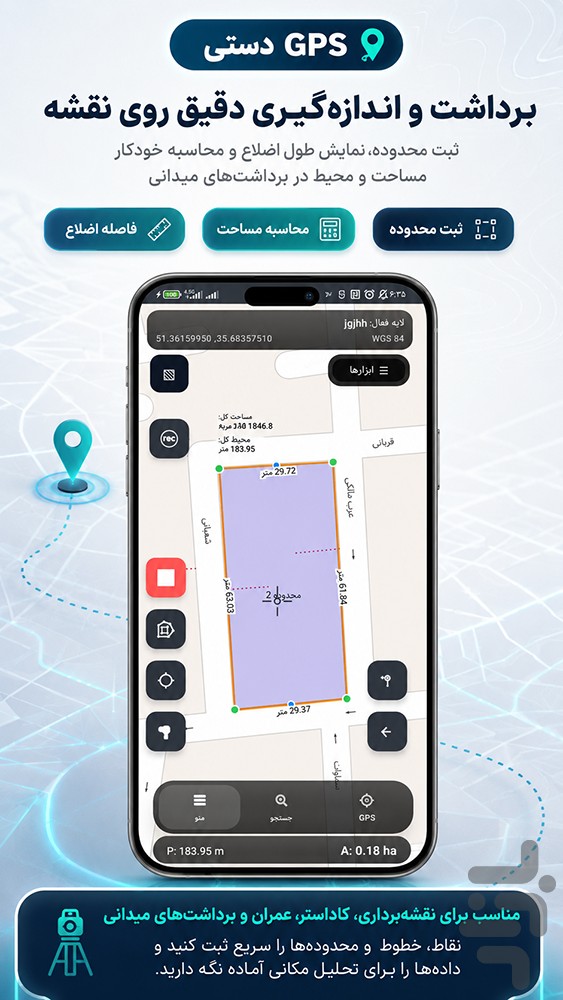


About this app
With this app, you can accurately record points, lines, and polygons, enter descriptive information for each feature, manage spatial layers, and save or export your data in standard GIS formats. 📊✅
With GPS Dasti , you can work faster and more accurately in field projects, surveying, cadastral mapping, agriculture, natural resources, environmental studies, construction, urban management, utilities, and spatial data collection. 🌍🚧🌱
This app is designed for GIS specialists, surveyors, field teams, engineers, organizations, and professional users. 👷♂️📐
Main Features of GPS Dasti:
📍 Record and manage points, lines, and polygons ⚡ Fast and accurate field data collection
📶 Support for offline projects
🗺️ Fully offline map usage by downloading maps from the app’s dedicated server
🗂️ Manage spatial layers and GIS data
📝 Add descriptive information to each feature
📋 Support for practical data entry forms
🛰️ Display base maps, satellite maps, and hybrid maps
🎯 GPS and GNSS support for more accurate positioning
✏️ Tools for editing spatial features
📱 GIS project management on mobile
📤 Export data in standard formats such as GeoPackage, Shapefile, GeoJSON, KML, CSV, DXF, PDF, and PNG
🧭 Compatible with GIS software such as QGIS
🌆 Suitable for urban, rural, construction, agricultural, natural resources, and environmental field surveys
GPS Dasti turns your mobile device into a complete GIS field data collection system. 🚀
With this app, you can record spatial data directly on site, add the required information to each feature, organize your layers, and finally prepare clean, accurate, and standard data for further processing, analysis, reporting, and presentation. ✅
One of the useful features of GPS Dasti is the ability to use maps completely offline. Users can download the required maps from the app’s dedicated server and then use them without an internet connection in remote areas or places with weak network coverage. 🗺️📶
This application is suitable for projects that require speed, accuracy, organization, and standard output; from recording land boundaries and routes to managing utilities, tree inventories, soil sampling, equipment placement, control points, urban features, and spatial databases. 🌳🏗️📌
With GPS Dasti , field surveying becomes easier, spatial data becomes more organized, and GIS project management becomes more professional. 🗺️✨
What’s new
🚀 بهروزرسانی GPS دستی — نسخه 26.8
در این نسخه، GPS دستی برای برداشت میدانی GIS، مدیریت لایهها و ثبت دادههای مکانی بهینهتر و پایدارتر شده است. 📍🗺
✨ تغییرات مهم این نسخه:
✅ اضافه شدن ورود به بازار
✅ بهبود مدیریت پروژهها، لایهها و دادههای مکانی
✅ ثبت و ویرایش بهتر نقاط، خطوط و پلیگونها
✅ پشتیبانی از GPS و GNSS برای برداشت دقیقتر
✅ بهبود کار با نقشه و پروژههای آفلاین
✅ افزودن دسترسی به سیاست حریم خصوصی سرویس نقشه
✅ نمایش راهنمای «نام لایه را انگلیسی بنویس» هنگام افزودن لایه
✅ بررسی و اصلاح مسیرها، شناسهها و اتصالات داخلی برنامه
✅ پشتیبانی از خروجیهای استاندارد GIS مانند GeoPackage، Shapefile، GeoJSON، KML، CSV، DXF، PDF و PNG
✅ بهروزرسانی نسخه برنامه به 26.8
GPS دستی موبایل شما را به یک ابزار حرفهای برای برداشت میدانی، مدیریت دادههای مکانی و آمادهسازی خروجیهای استاندارد GIS تبدیل میکند. 🗺✨