- Install
- 82 K
- 874
- 4.3
- Category
- Travel & Local
- Last updated
- 2026 October 22
- Size
- 220 MB
View antivirus results
checking the app
App screenshots




About this app
Detailed offline maps and navigation
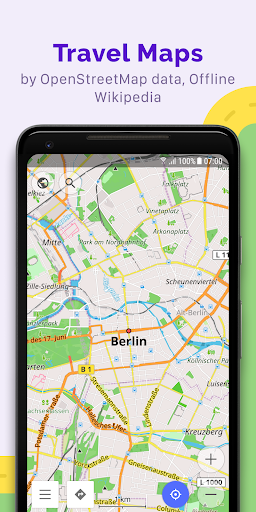
OsmAnd combines detailed offline maps, GPS navigation, flexible route planning and extensive GPX tools for journeys where map detail and control matter. It is designed for driving, cycling, hiking, motorcycling, travel and navigation beyond reliable mobile coverage.
Offline maps and routing
• Download maps for countries and regions
• Calculate routes and receive turn-by-turn voice guidance offline
• Search for addresses, places, points of interest and coordinates
• View lane guidance, speed limits and route information
• Avoid toll roads, ferries, motorways, unpaved roads or selected streets
Routes for different activities
Dedicated profiles adapt routing and map settings for driving, motorcycling, cycling, walking, hiking, trucks, off-road travel, public transport and boating.
Depending on the selected profile, routing can consider vehicle dimensions, road restrictions, surface types and elevation. Add intermediate destinations, adjust routes on the map and choose preferred roads.
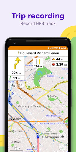
GPX tracks and trip recording
Import GPX files, follow tracks during navigation or record a new journey. Tracks can be displayed, organised, analysed and shared with distance, speed, elevation and time data.
GPX tools support hiking trails, cycling routes, motorcycle tours, off-road trips and routes planned in advance.
Outdoor and topographic maps
Explore hiking paths, cycling networks, mountain-bike routes and other outdoor details. Optional topographic features include contour lines, hillshade, terrain, slope information and 3D relief.
Elevation profiles help evaluate climbs and descents before and during a journey.
Customisable maps
Choose which details appear on the map, including points of interest, public transport, road information, boundaries, favourites, tracks and additional layers.
Map styles, route appearance, widgets and navigation settings can be configured separately for different activities. Custom online maps and overlays can also be added when a connection is available.
Travel and driving tools
• Android Auto support with eligible plans
• Parking position, favourites and map markers
• Public transport routes and stop information
• Wikipedia and travel information
• Speedometer and speed-limit alerts
• OsmAnd Cloud backup and synchronisation
Open data and privacy
OsmAnd is open source and uses map data from the global OpenStreetMap community. OpenStreetMap data can be improved by contributing missing places and corrections.
OsmAnd contains no advertising. Core maps and navigation can work offline, reducing dependence on online services and the need to send route requests to a server.
Continuously improved
Years of regular development have expanded OsmAnd into a detailed navigation platform. Updates continue to refine routing, search, map rendering, performance, stability and everyday usability while addressing reported issues across different devices and activities.
Core mapping and navigation features are available free of charge. Additional map downloads, topographic data, cloud services and advanced tools may require Maps+ or OsmAnd Pro.
What’s new
• Refreshed search UI: sorting, category filters, cleaner look
• Attach photos and media to Favorites
• Favorites: subgroups support and pinnable folders
• Coordinates: search, map grid, and POI display now support EPSG and Maidenhead locator
• Fixed navigation interruptions; switch between Standard and Fast routing
• Set Android Auto map scale separately from your phone
• New spatial search — find places and search around a place
• Astronomy added solar & lunar eclipses